
3-day hike in the Adirondack Mountains
By Tristan-OH
Finally back to the Adirondacks of Northern NY after not being able to get out at all last year. I was just dying to get out to the mountains again! Had planned a couple of trips during my recent 3 week vacation but we were rained out. And my mom ended up having to work after securing the days off.  So this ended up being a last minute solo hike on a narrow window of what was predicted to be a few decent weather days. I'd leave before dawn the first morning (3hr drive to the mountains), hike all day, tent that night on the trail, hike and tent the second day, and the third I'd head back home after a full day of hiking. The trip started on the 5th of July so the area was a lot more busy than usual, though with all the horror stories of how crowded the High Peaks area is during popular summer weekends I was pleasantly surprised how few I came across.
So this ended up being a last minute solo hike on a narrow window of what was predicted to be a few decent weather days. I'd leave before dawn the first morning (3hr drive to the mountains), hike all day, tent that night on the trail, hike and tent the second day, and the third I'd head back home after a full day of hiking. The trip started on the 5th of July so the area was a lot more busy than usual, though with all the horror stories of how crowded the High Peaks area is during popular summer weekends I was pleasantly surprised how few I came across.I won't give a full account of everything as it happened or this will be way to long but I'll quickly summarize and then get to the pics!
I'm working towards being a '46er' which means a person has climbed all of the 46 highest peaks and listed in the registry. So the mountains I hiked were ones towards that goal primarily. First day would take me up Lower WolfJaw Mountain, which is the smallest of the Great Range and one I planned to do when I did my Great Range Trip 2 years ago but ran out of time on that day. Then after coming back down into the valley below I would visit several waterfalls that where in the area as I headed across to the next range over that I would hike the next day. After setting up camp I also visited some scenic overlooks nearby. Day 2 would be to hike Mt. Colvin and Blake Peak, then hike all the way back out to the truck that evening and relocate camp over where I would hike the final day, which was the longer but scenic route up Rocky Peak Ridge.
All went well, despite a couple wrong turns and bad choices. Hiked barefoot on all the trails on all the mountains except the short road walk back to my truck across private land on day two. It was sand/gravel and barefootable just was trying to save my worn down soles for a seemingly long final day. And make me feel better about lugging my Unshoes along the whole way.
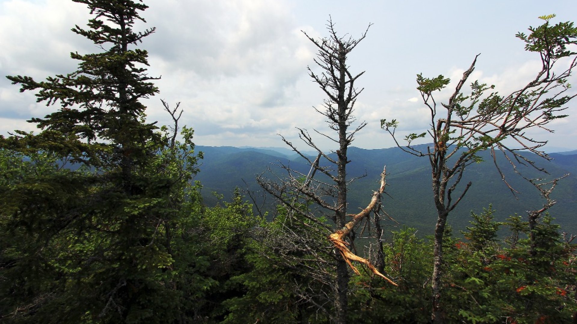
Lower WolfJaw Mountain had a wooded summit, but you could still see the area around and distant valleys and peaks.
Typical trail conditions, steep, rocky, wet, and mucky. Definitely a bit challenging at times, and made worse by carrying a full overnight pack.
First of many nice waterfalls in the area.
Log bridges crossing picturesque streams.
Rainbow Falls, 150' high, is often a destination on its own. I'll have to return some day when I have more time to photograph it better!
Bridge across the Ausable River near the outflow from Lower Ausable Lake.
On the bridge looking Ausable River with part of Sawteeth Mountain in the distance.
Lower Ausable Lake, or perhaps this part is river, not sure.
Ausable Lake. The mountains flanking the lake to the left side are Mt Colvin and Blake peak, which I'll climb the next day.
View from Indian Head lookout over Lower Ausable Lake. Colvin and Blake to the left, and Sawteeth and some of the Great Range to the right.
Well that's 10 pictures, I forget what the limit is, but need to take a break and mow the lawn anyhow. That just about wraps up day 1. More to come later...