Zion Traverse

rickwhitelaw

Barefooters
Apr 27, 2011
1,870
2,525
113
Beryl Utah
I did the East Rim trail yesterday. I did an out an back so I got to see the trail both directions. Now, trying to decide weather to put this section of the trail on the start or the finish of the Zion Traverse is a toss up at this point. I really can't make a recommendation without doing the western sections of the Zion Traverse. One consideration would be the heat. I would not want to do this trail west to east in the heat. Lots of climbing and then exposure on a burned plateau. The final decent wouldn't be bad though. A gradual decent to the trail head near the highway. Also, finishing up with this trail would mean closer access to recovery drinks in the town of Springville or your campsite in Zion.

I'm not going to go over the trail much. Here is a good description. http://www.citrusmilo.com/zionguide/eastrimtrail.cfm

Now from a barefoot point of view. I would say most of the trail is barefoot friendly. You have a whole mix of condidtions. Pavement, hard packed sand, forest single track, gravel, and deep sand. One stretch of gravel and rock chips that might have to be taken slower, about 2 miles of rough. If I were to do this trail again one way, I would give it a shot barefoot.
 
  • Like
Reactions: NickW
The Zion Wilderness Guide says this about the Narrows:

FOOTWEAR

Hiking The Narrows is like walking on slippery bowling balls. It requires balancing on algae-coated rocks in the middle of a swiftly flowing river. Sturdy footwear is essential. Hiking boots with good ankle support are best. Sandals and bare feet are not appropriate. Inappropriate footwear often results in twisted ankles and crushed toes.

What are your thoughts on that? Exaggeration? True? I'm suspicious since this is what's in the newspaper for Bryce Canyon:
bryce02.jpg


Of course, Bryce was not problem at all for me hiking barefoot.

I'll be at Zion in early May, so the water may be too deep and fast to even think about doing the Narrows. On the other hand, with the drought, there may not be all that much water after all.

Thoughts?
 
The Zion Wilderness Guide says this about the Narrows:

What are your thoughts on that? Exaggeration? True? I'm suspicious since this is what's in the newspaper for Bryce Canyon:

Of course, Bryce was not problem at all for me hiking barefoot.

I'll be at Zion in early May, so the water may be too deep and fast to even think about doing the Narrows. On the other hand, with the drought, there may not be all that much water after all.

Thoughts?

I find most things in the guides exaggerated. Like trail ratings, length of time, amount of water to carry, etc., but these guides are geared toward the tourist. The signs and guide for Bryce are ridiculous. I had the same barefoot experience there. Trails were perfectly fine barefoot.

As for footwear in the narrows, I don't know, I don't have any river hiking experience shod or barefoot. The slippery rocks is a valid point, but with caution and trekking poles, I believe barefoot would be fine. The smashed toes and ankle rolling, not likely. If rocks are rolling around because of the current, then it is too fast to be hiking in. In my opinion, hiking boots would cause more rocks to become dislodged to roll onto your foot.

This calls for a test. I'll load up a backpack of footwear, although I don't own hiking boots, and give them a test along with being barefoot.

I usually link to this website for the Zion trails. http://www.citrusmilo.com/zionguide/ He has good trail descriptions and pictures. Here is what Joe says about footwear in the Narrows.

Footwear: Since you will be hiking in knee-deep water almost all of the time, strong water-friendly footwear with toe protection is a must. Some of the stronger models of Keen sandals are okay, but even better are any trail runners that do *not* have GORE-TEX, so they can breathe and drain. (A shoe like the La Sportiva Imogene works great; they offer good foot protection, good grip, drain and dry quickly, and are good for dry hikes as well.) Also popular are the FiveTen Canyoneers, although they are a bit bulky. And a good pair of neoprene socks will be much better than cotton to keep your feet warm and blister-free.

Footwear to avoid: light sandals or water shoes like Tevas. They will likely break before the end of the day and if your toes are exposed, your toes will get smashed in the rocks. Also avoid big heavy hiking boots; while they will protect your feet, they will feel very heavy and most boots take too long to dry out and will get a bad case of the stinks.
 
I'll be at Zion in early May, so the water may be too deep and fast to even think about doing the Narrows. On the other hand, with the drought, there may not be all that much water after all.

Thoughts?

Extremely low snow pack this year, you might be ok. You could check in with the backcounty desk ahead of time. I would also recommend a "bottom up" hike vs. a "one way" hike to test the conditions. If the flow is too high, the trail heads will be closed off, of course. Have a great trip.
 
Thanks for the info!

I took a look at last year at the time I'll be there. Things were also on drought then. Here's the chart I got.

may_streams2012.jpg


The triangles are the average; the blue line is the actual. I'm guessing I can give it a try.

We (my son and I) won't be backpacking it, just car camping and day hikes, so we'll just head upstream with me barefoot until I decide I'm an idiot. :)
 
Wildcat Canyon and West Rim Trail Report.​
IMG_0979_zps6b205e80.jpg
The day was perfect. My son and I met friends at the Zion Visitor Center and shuttled up to the trail head. I hadn't been up the Kolob Terrace road in years and I forgot how beautiful it was. We got dropped off at the Wildcat Canyon trail head (two of the guys went back to Zion to do the Narrows hike, so that made our group 4). The Wildcat Canyon trail does not get much traffic. Most people use it to access the famous Subway hike, so beyond that split, the trail is seldom traveled. We soon passed the Connector trail split where I made a mental note (I need to explore this trail later to complete my Zion Trek scouting). The trail continued through some nice forest before opening up with views of Wildcat Canyon. I was really surprised that there was still some snow on the trail and muddy conditions. This was the last week of March on a low snow year. So on a normal year the entire trek might be difficult to do before April. After skirting around the canyon, the trail climbs up near Lava Point, the trail head of the West Rim. Most people get shuttled to this point to start the hike. The view to the North was pretty good at this point, but the main canyons of Zion were not visible yet. The trail made ups and downs along a burn scared plateau and then comes to this overlook.​
IMG_0971_zps9410a836.jpg
The trail then descended into a pretty area called potato hollow. Oh at this point I wish I could have taken my shoes off, the trail was perfect. Then more uphill with snow on the North slopes and then we came to the view in the first photo. Breathtaking. The trail then headed East and we got views of the main Zion canyon. Here is where the downhill really begins. Several miles of trail chipped out of the sand stone and then a crossing of slick rock.​
IMG_0987_zps42935879.jpg
More decent to the Angel's Landing trail. At this point we were 19 miles into the hike so I had to convince the others that we need to go to the top. This is one of the most popular spots in Zion and quite a few people were there. This made the hike to the top very slow, but it was worth it. More incredible views from the top. After descending Angel's Landing the last part of the West Rim is pretty steep downhill, but everyone was doing well. My son even ran the last section to get to water quicker. Riding the shuttle at the end of the hike back to the visitor center was kind of a pain, but nothing could have spoiled this day. Incredible hike, 22 miles total.​
So can these trails be done barefoot? Yes, I believe so, although I would do it from the bottom up. Several sections on the upper plateau are a bit rocky, but the rough sections don't last long. It would also be better later in the season, less snow.​
Next up, Lee's Pass trailhead (Kolob Section, see above) to Hop Valley. I plan to do an out and back (around 27 miles).​
 
La Verkin Creek Trail and Hop Valley Trail Report:

Once again, I will link to Joe's guide for better trail descriptions and pictures.
http://www.citrusmilo.com/zionguide/laverkincreek.cfm
http://www.citrusmilo.com/zionguide/hopvalley.cfm

I arrived at the Lee's Pass trail head early in the morning. I thought I had the place to myself, not a single car in the ranger station or at the first trail head (Taylor Creek). I was surprised to see several cars at the Lee's Pass parking area. I saw one group of runners preparing, actually only one guy was running, the other two came back to their car. I asked if he was doing the whole trek. Yes, they replied. Someday, I told them. Looks like I would have Hoka footprints to follow. Gathered my gear and headed out. My goal was to hike the technical sections and slowly run where I could. I am pretty familiar with the first part of today's journey. I really enjoy this hike, very scenic. The trail was in rough shape. They allow horses on this trail, which I have no problem with, but the horses went out in wet conditions and trashed the trail. It was now rock hard dry clay with horse tracks. Pretty slow going until the trail smoothed out. One of my favorite sections of this hike is the areas in between the stream crossings. Very barefoot friendly, but doesn't last long.
242f84e5-58ce-4314-b206-632a4984a46c_zpsfce0ec14.jpg


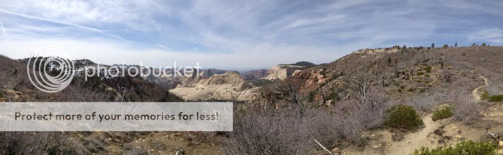
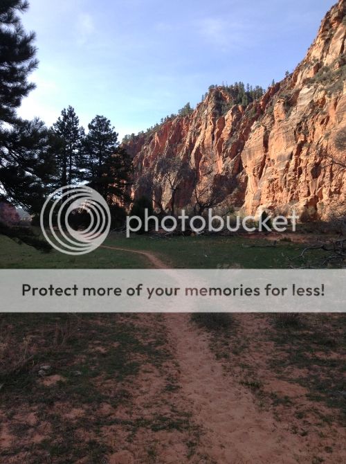
The trail then goes up and over a ridge and you see the La Verkin Creek section of the trail. About 2 miles of sandy trail. The trail to Kolob Arch splits off to the north while the La Verkin Creek continues to the East at 6 miles into the journey. After another .3 of a mile and crossing the main creek, the Hop Valley Trail splits to the south. It was a good uphill to get out of the canyon and into Hop Valley. Some people call it Plop Valley because of all the cow crap, but at this time, there wasn't any cows to be seen. Quite a few stream crossings and miles of sand. Very scenic. I love the sunlight on the red rocks here. (notice the sandy trail)
IMG_1003_zps8d9b629f.jpg

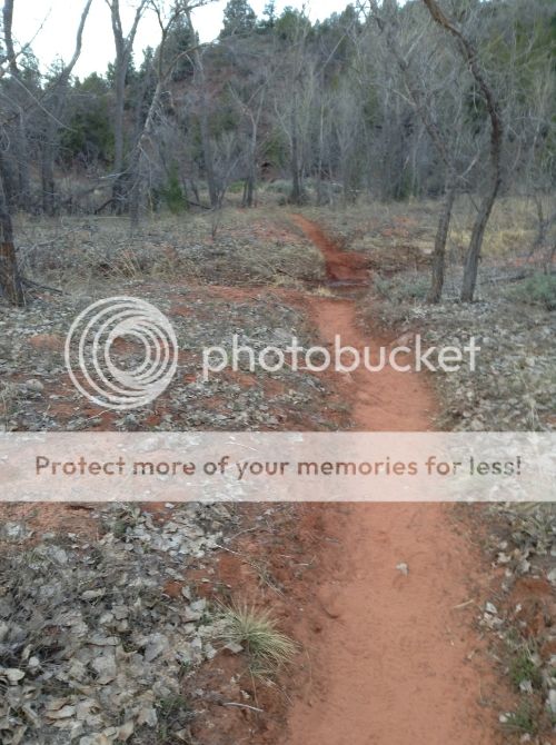
One more good uphill and then a gradual decent to the Hop Valley trail head. Note: Just before the trail head, the Connector trail splits off. This was not marked as the Connector Trail, the sign is marked Wildcat Canyon with an arrow.

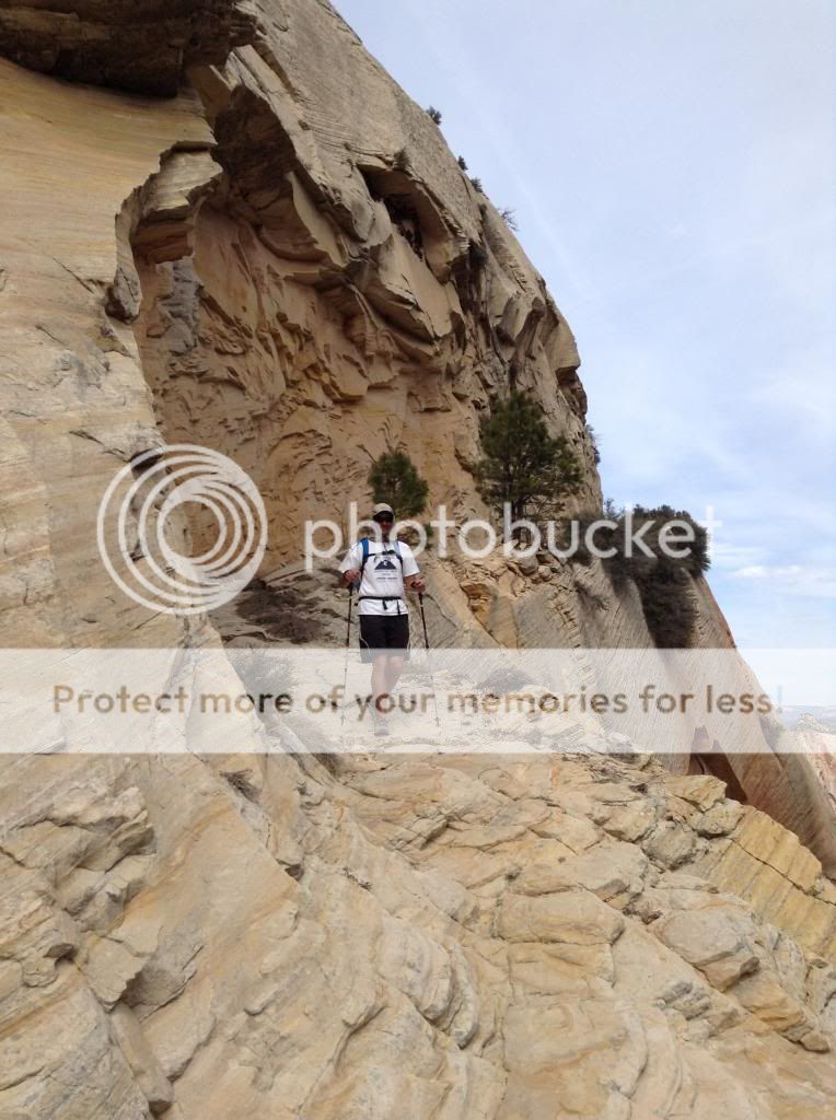
OK, halfway done and I was feeling good. Pace was well within my goal. Shoes off (MT110 winter boots, which worked perfectly for the sand and stream crossings). Here is the view heading back. I've got to return beyond the big red rocks in the center.
IMG_1005_zps70471c9f.jpg


I really enjoyed being barefoot for this return trip on the Hop Valley trail. My legs did not seem as heavy and the stream crossing were not a problem. The two accents (descents on the return trip) were not a problem, I just had to take them slower. I arrived back at the junction of the Kolob arch trail and decided I had come this far, I better go see the arch. I remained barefoot and this took quite a while. This trail is technical. Hind-site, I probably should have put my sandals on. Did the remainder of the sandy part of the La Verkin trail barefoot and then put on my Unshoes sandals for the rest of the way. It started to get hot and I was running out of water. A few clouds and soaking my hat in the creek saved my bacon. I celebrated in my mind as 26.2 registered on my GPS. Another marathon distance completed. The hard horse tracks were hard on my feet, but I wasn't going to mess with putting the MT110's on. At this point I was done running and completed the uphill to the trail head hiking.

28.5 miles total with 10 of those being barefoot. About 8 hours. I did not anticipate the elevation change and the toll the sand would take. I was pretty tired at the end. Still a great hike and a successful scouting trip. I have now seen most of the Zion Traverse trails and can do some good planning for the whole journey. I am now thinking that West to East would be the best way to go. Putting the Hop Valley and La Verkin trails at the end of the hike with tired legs would be very difficult.
 
  • Like
Reactions: DNEchris
Dude! Hubby and I are planning a vacation that includes a stay here - just so I can run amidst the stunning scenery!
 
I got a little lazy about keeping this thread updated.

Early May in prep for my Grand Canyon R2R2R I completed my first significant Ultra distance in Zion. I went from the East Rim trail head down to the Grotto. Up the West Rim trail to the Wildcat Trail to the Connector Trail. Hard for me to remember the little details of the hike, but I had a slight bonk near the end of the West Rim Trail. My feet were sore from all of the rock chips on the trail. I was wearing Altra Superiors minus the lining and rockplate and they were too small and I was getting some TOFP. I arrived at the trail head to discover my aid vehicle not there. I was out of water and hot. I had to hike an additional one plus miles to get to the car (the road was blocked by downed trees). My son wanted me to call it a day, but I refueled, re-hydrated, and switched out shoes. After a slow, hot, uphill stretch on the Wildcat trail I hit some downhill and started running. I was here that I discovered that it is possible to run exhausted and even felt better than walking. I finished out the Wildcat and Connector trails strong. Around 35 miles total, I can't remember my time. Scouting of the trek complete.

After a summer and fall of successful Ultra distance runs I decided it was time to complete the entire trek. On October 26, 2013 I completed the Zion Traverse or the Trans Zion Trek. 48 miles, 14 hours 10 minutes. Self supported (no water, food, or gear drops) for the entire trek and solo for the first 36 miles. My brother and sister-in law joined me for the final section. One of the most beautiful adventures and one of the best run/hikes I have completed. Only a few minor problems. I hope to give you a better report soon.
 
Wow Rick that is very impressive self supported is crazy. Do you have a water filter?

Sorry We haven't made it out there yet Sarah ran her first hundred at the Stagecoach Flag to Canyon run a couple of weeks back and I was on pacing duty at the Javelina Jundred last weekend. And there goes October. We really do want to make our way up there though is the season over or can you do winter runs up there?


Thanks Abide, good to hear from you. I have a LifeStraw filter. One of the best $25 I have ever spent. Works great if you can scout the trail and know the water sources. Unfortunately, one of the springs I was counting on was dry so I was out of water for 5 miles. The day wasn't too hot and I slowed the pace, but it would not have been good on a hot day. The other spring was just a slow drip coming out of a pipe with 5 miles to go. By then the evening cool was coming in and the last section is mostly downhill, so I was ok. I went with bottles instead of a bladder because of easier filling at the springs. Then used the LifeStraw to drink out of the bottle. Somewhat of a pain, but it was nice not carryng a big load of water.

Sarah ran a hundred!! Incredible, give her a huge congratulation from me! I just had a friend run Javelina (Cory Reese). I'll think about that one in the future. From his race report it was a hot one, which I seem to struggle in.

Snow usually shuts down the upper trails of Zion for running in December, but plenty of good stuff down lower including most of the Zion 100 course. Think about coming up sometime. Also, my friend Matt is organizing some pretty interesting Ultra races. Check out: http://www.ultra-adventures.com/ I am going to try to help out and/or run in these races.